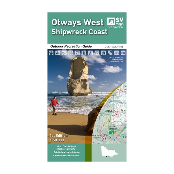
SPATIAL VISION MAP - OTWAYS WEST

Quick Overview
SCALE: 1:50,000
COVERAGE: Apollo Bay to Peterborough, including Port Campbell, the Twelve Apostles, Princetown, Beech Forest and Lavers Hill.
IDEAL FOR: Bushwalking, mountain biking, trail bike riding, car touring, four wheel driving and water sports
EDITION: 1
SIZE (folded): 135 mm x 250 mm
SIZE (unfolded): 675 mm x 1000 mm
This new map of the Shipwreck Coast (Otways West) provides detailed topographic information to explore the region and the many recreational features on offer. This fascinating region includes the Great Otway National Park, Twelve Apostles Marine Park and Port Campbell National Park.
The map includes a detailed description and map of the complete route for the 100km Great Ocean Walk from Apollo Bay to the Twelve Apostles. The map also includes track notes for numerous other long and short walks in the region as well as the location of popular 4WD and mountain bike trails in the area, the many waterfalls, lookouts and shipwrecks that make this area famous.
The reverse of the map provides detailed information about the history of the region, the main tourist sights, flora and fauna of the region and GPS references for the main recreational locations.
Standard/Free shipping to major capitals takes 2-5 business days (after dispatch), with occasional delays.
Order before 11am - we usually ship the same business day!
Choose Express Post for priority packing and faster shipping.