ROOFTOP BAIRNSDALE - DARGO - OMEO
Quick Overview
Bairnsdale Dargo Omeo Rooftop Map covers the area from the Gippsland Lakes region to the Victorian High Country. Scale is 1:100,000.
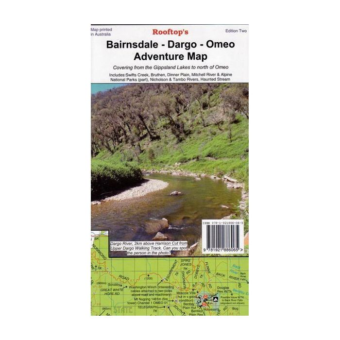
Bairnsdale Dargo Omeo Rooftop Map covers the area from the Gippsland Lakes region to the Victorian High Country.
Areas include Paynesville, Metung and Lakes Entrance in the south to Dinner Plain, Omeo and Mount Nugong in the north. The map includes Dargo, Mitchell River National Park, Swifts Creek, Cobungra, Victoria Falls, Cassilis, Deptford, Bullumwaal, Mount Baldhead, Haunted Stream and a huge amount of forest in between. A feature is the East Gippsland rail Trail which can be followed from Bairnsdale to Colquhoun, south-east of Bruthen.
Scale is 1:100,000. The reverse of the map has a 1:50,000 scale enlargement titled 'Dargo - Swifts Creek Forest Activities Map' with contours. All parks, reserves and state forests are shown and more than 6000km of roads and tracks have been plotted using GPS mapping.
Standard/Free shipping to major capitals takes 2-5 business days (after dispatch), with occasional delays.
Order before 11am - we usually ship the same business day!
Choose Express Post for priority packing and faster shipping.
Calculate Shipping