VICMAP 50K WILLIS 8524-S
$12.95
Quick Overview
1:50,000 Victorian Topographic Map of the Willis area.
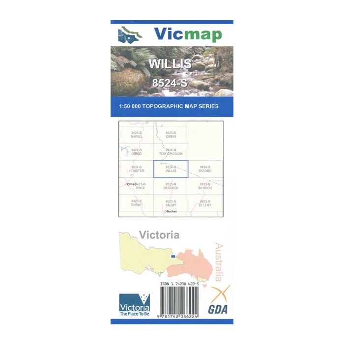
Willis 1:50,000 scale Vicmap Topographical Map is used for Walking, 4WD, Fishing, Camping, Motorcycle, both On and Off Road, Gold Prospecting and for those simply going for a family weekend drive.
Topographical maps show not only Contours of the Terrain but Walking Tracks, Sealed and Unsealed Roads, Rivers, Creeks, Lakes, Historical Points of Interest, Old Mine Sites and National and State Park areas.
Places of Interest
- Alpine National Park
- Alpine Walking Track
- Beehive Creek
- Buchan Headwaters Wilderness Zone
- Buchan River
- Cobberas
- Cobberas Wilderness Zone
- Kosciuszko National Park
- Little River
- Kosciuszko National Park
- MacFarlane Flat
- Native Dog Flat
- Round Mountain
- Snowy River
- Suggan Buggan
- Tingaringy Wilderness Zone
- Willis
Standard/Free shipping to major capitals takes 2-5 business days (after dispatch), with occasional delays.
Order before 11am - we usually ship the same business day!
Choose Express Post for priority packing and faster shipping.
In stock
Calculate Shipping


You may also like